This year, the Davis Farmers Market turns 50. Its younger sibling, the UC Davis Farmers Market turns 20. The two milestones are connected by more than a name — together, they're part of a larger Davis story about students, farmers and community members finding new ways to connect and think about food.
New video takes a playful look at Naomi Kalman’s work behind the scenes, as she launched a new campus map for UC Davis this summer with key collaborators from throughout FOA.
UC Davis has a new digital campus map, and it's built to keep getting better. While the information on the map will look familiar, the experience and capabilities are new. The map is interactive, mobile-friendly, easier to maintain, and provides a foundation for adding new information and functionality over time.
Check out the proposed transit hubs on an interactive map and leave a comment. Your feedback will be used to inform future transportation planning efforts.
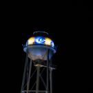
Affectionately known as “Touchdown Tower,” this 162-foot utility landmark just completed a full restoration and now features two UC Davis logos and programmable LED lighting, transforming it into a new symbol of Aggie pride.
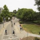
The charge of Design and Construction Management’s Campus Planning team is making sure that the built environment — especially, all the in-between spaces — comes together to create safe and enjoyable experiences.
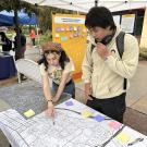
Whether you have feedback, questions, or bold ideas about getting around on campus, we urge you to join the conversation. If you haven't already taken part in Moving Forward Together, now is the time!
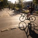
At UC Davis, mobility isn’t just about getting from point A to point B—it’s part of who we are. With one of the most vibrant cycling communities in the country, our campus is a national model for green transportation. But even strong systems can improve, and that’s where our community engagement comes in.